Ice age up close: New GrenzWelten geostation in Udenborn
Anyone interested in finding out how the local region was shaped as a glacial landscape and how the gravel deposits on the Eder are connected to this now has a good opportunity to do so in Wabern-Udenborn. The GrenzWelten National Geopark has installed a geostation at the Udenborn picnic area. The construction and installation of the geo-station was subsidised with funds from the Schwalm-Aue regional budget funding programme. Further geostations and information centres are planned in the region by GrenzWelten.
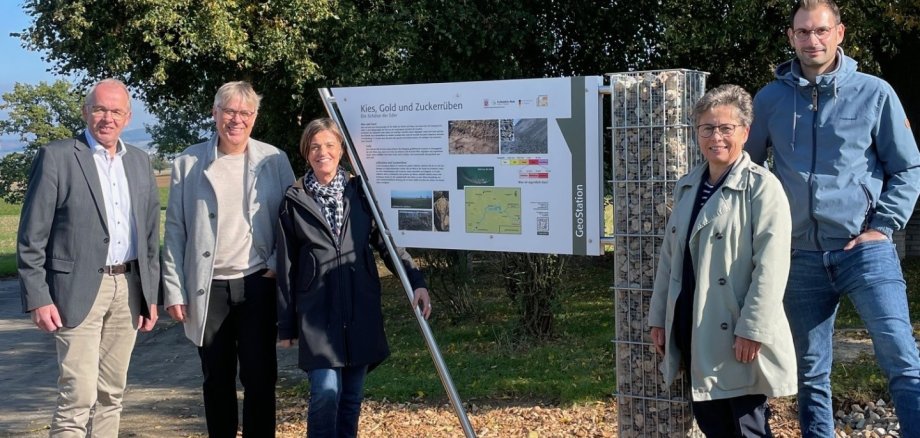
With its modern information board, the new geo-station in Udenborn invites visitors to discover more than just the special features that characterised the Ice Age landscape thousands of years ago. The gravel deposits on the Eder and their significance for the region are also presented. The gabion (wire gravel box) on the information board is filled with Udenborn gravel provided by the local company Irma Oppermann.
Gravel deposits, deposits from the Eder and their extraction have had a significant impact on the region since prehistoric times and continue to do so today, together with the long tradition of agricultural utilisation. The new geo-station takes visitors on a journey through the history of the Lower Saxon depression and the settlement area between coal and gravel, following in the footsteps of the Ice Age. The information board is to be integrated into the planned "Kies und Ederaue" cycle route as an example of successful local recreation and sustainable knowledge transfer.
Caption: Wabern mayor Claus Steinmetz, Geopark manager Dr Georg Bresser, regional manager Sonja Pauly, local mayor Anke Koch and head of the building authority Tim Zier present the new geostation at the Udenborn picnic area. (Photo: Regionalentwicklung Schwalm-Aue e. V.)